Nabbin’ Madden Bike/Run Duathlon Workout – Level One Variation (Level Two, C(om)ing Soon!)
Start Location: halfway between Durango and Mancos, Colorado
Equipment: although i used a Cross Bike for this particular day, a MTB would probably serve you better. Running shoes. Hydration Pack with Tailwind.
Ilg’s Roundtrip Time: just under 3 hours. essentially 2 hours up, less than one hour down.
Stat Attack: 3,500′ of ascent almost perfectly split between the bike and run. 16-mile round trip. summit elevation (the turn-around point) is just under 12,000′
Optimal Season: July – October. the wildflowers are surreal in mid-July during most years. Snow must be navigated up high until August during most years.
Logistics: Drive (or, if you are a Hard Wo/Man? RIDE) 20 miles west from Durango on HWY 160 toward Mancos* ( you know, Mancos IS “The Gateway To Mesa Verde”!?). At the top of Mancos Hill, flip a hard right onto FS316 (Madden Peak Road). Drive (or ride) up one mile to the intersection of the Old Railroad Grade. Park and prepare for the uphill hurt.
see captioned pics below for more details.
regardless? do this!!
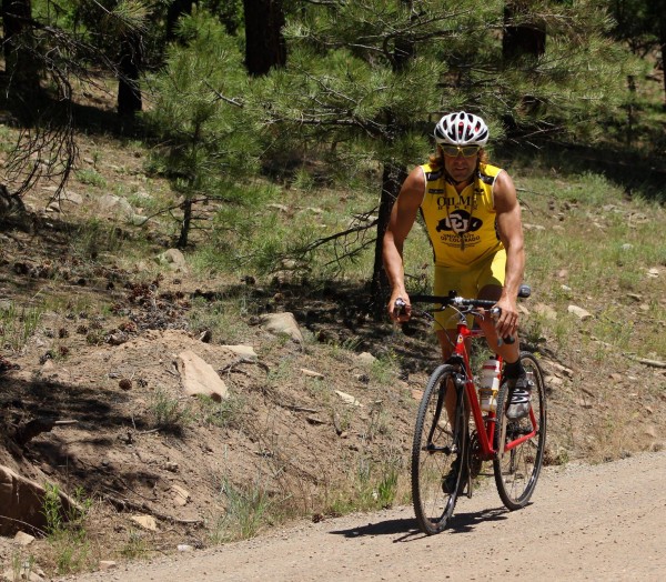
Bike Up (and i do mean ‘up’): generally takes feeble ilg a smidgen over an hour of a solid low Zone 3/high Zone 2 effort to ride up the 6-mile mostly gravel, then jeep road approach
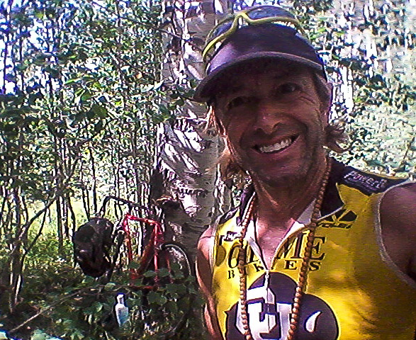
at the Bike/Run Transition…no need to lock your bike, you will likely be the only Human Being up here…i like to use this 100 year-old Aspen Being to stash my pony…switch into your running shoes here and prepare to do more uphill battle..
at about one mile into your Run Up, the vista opens a la Mount Taylor Winter Quadrathlon…over my Crown Chakra lies The Sleeping Ute located just southwest of Cortez, Colorado. if you squint, you can pick out the mysterious, and magical Carrizo Mountains which are in the Navajo Reservation and pack an uphill punch equal to or harder than this workout! those are Mule Ear Sunflowers, in case you are wondering!
exiting timberline (around 11,000″), you’re likely to find and cross snow…when i do this workout earlier than July, this meager snowfield is actually a 1,000′ long white-carpet over the talus toward the summit!
After the snowfields, upon cresting a ridge, you see the Summit Cairn (shown in this pic by Sandra Lee just off my left shoulder during my descent). it may take you longer to get to this cairn than you first think! The journey gets harder closer to the summit!”
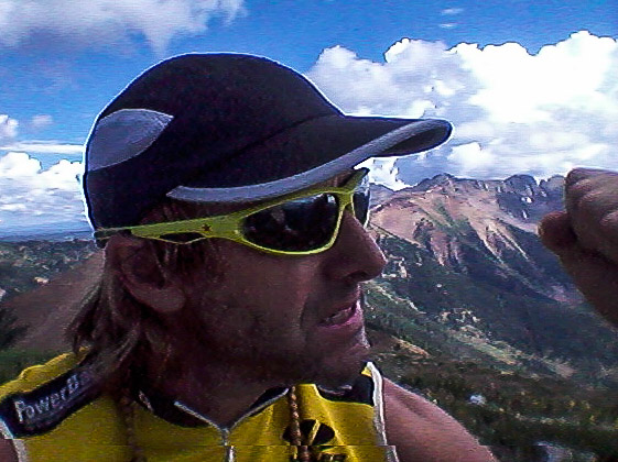
YES!!! FIST PUMP!!! THE SUMMIT of MADDEN PEAK!!!
to your immediate south is Parrot Peak; go nab that summit as well if you are up for it, only took me about 24-minutes to nab the summit and return to my down route on Madden. To your east is Silver, Lewis and Baker Peaks. North are the Babcock Spires (shown in the above pic) as well as another ilg-classic workout; Diorite Peak over Tomahawk Basin. Just northwest you can see the Telluride peaks and close enough to touch is Helmet Peak.
now? do some Pranayama to uptake the intense LIFE FORCE inherent to such summit vortices, and reverse everything you just came up! HOW STINKIN’ BLESSED ARE YOU!?!?
ilg-guided workouts up here are available.
Get OUT and DO, so as to BE!!!
head bowed,
coach ilg
* pronounced, MAN-kiss


 These teachings are the "Rasas" or "sap" of Wholistic Fitness. You’ll find insights to ponder, student chi to keep your own chi topped off, and plenty of proven training techniques to test on your own body, mind, and spirit! Also, you’ll find my very popular Race Reports, and news of our Sangha’s (community’s) latest transpersonal fitness adventures!